About
Welcome to my portfolio
I am a GIS Analyst at Larimer Emergency Telephone Authority (LETA 911).
I apply my skills in geospatial programming, data analysis, and visualization to
support critical emergency response systems.
I completed my MS in Geography with a concentration in Data Analytics
from the University of North Texas,
and Bachelors in Geomatics
Engineering from Kathmandu University. I am proficient in tools like ArcGIS Pro,
ArcGIS Online, ArcGIS Experience Builder, ArcGIS Survey123, Tableau, and Python.
I have working experience at International Center for
Integrated Mountain Development (ICIMOD) with proficient group
of experts in multi-disciplinary and
multi-cultural environments. I have worked as
GIS Officer at Naxa where I was involved in humanitarian
and disaster risk assessment sector. The journey as a
Geomatics Engineer has developed my passion to solve
critical environmental problems.
Behind this profile, there is a genuine person. In my leisure
time, you might find me: hiking, travelling, reading about
technology, playing guitar and ukulele, involving in social
organizations or playing football.
- Email:prashantthapaliya8989@gmail.com
- Website: prashantthapaliya.com.np
- Completed: Masters
- City: Colorado, US
Resume
Summary
Professional Experience
GIS Analyst
July, 2024 -Present
Larimer Emergency Telephone Authority (LETA 911)
- Built and maintained geographic datasets and associated data sets for dispatch personnel and emergency response authorities
- Developed operational efficiencies by reviewing workflows, procedures, and processes related to managing all GIS data within the system.
Research and Teaching Assistant
Sept, 2022 -June, 2024
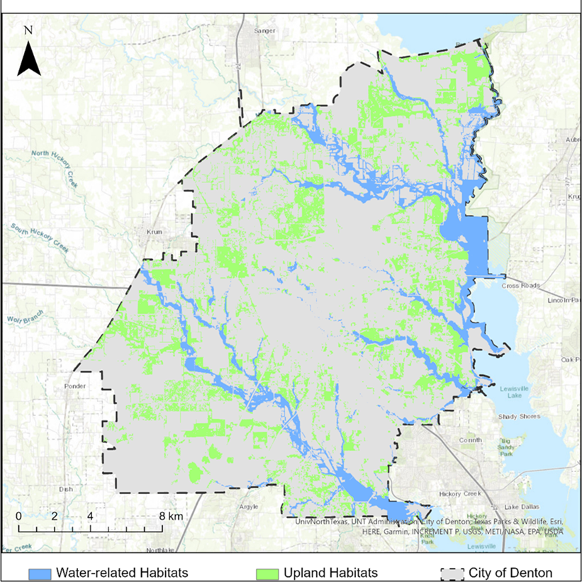
- Researched and assessed environment-sensitive areas using airborne LiDAR point clouds and GIS
- Assisted with grading and tutoring the undergraduate courses – Introduction to GIS, Introduction to Python Programming, and Advanced GIS Programming
GIS Summer Intern
July, 2023 -Aug, 2023
- Researched and developed a methodology to analyze High Injury Networks of different cities in Texas.
- Contributed to Vision Zero Texas and showcased the works at the North Central Texas Council of Governments (NCTCOG)
Open Source Contributor
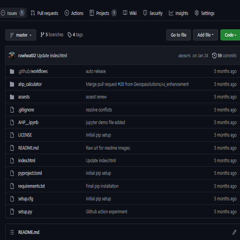
- Develop AHP_calculator for multi-criteria decision analysis
GIS and Remote Sensing Officer
Jan, 2022 -July, 2022
- Research and develop effective toolkit for 3D maps, and rendering through WebGIS systems
- Supervise and manage the junior and mid-level staffs on carrying out GIS and mapping projects.
GIS Analyst
Aug, 2020 - Oct, 2021
International Center for Integrated Mountain Development (ICIMOD)
- Compile database and maps of Cultural Ecosystem Services for Risk Assessment of Kailash Sacred Landscape
- Analyzed the change in forest area in years 2000, 2010 and 2020 for fuel assessment using Google Earth Engine
- Develop tool for automated risk assessment (R framework)
GIS Analyst
July, 2019 -July, 2020
- Identification And Mapping Of Humanitarian Open Spaces under International Organization for Migration (IOM)
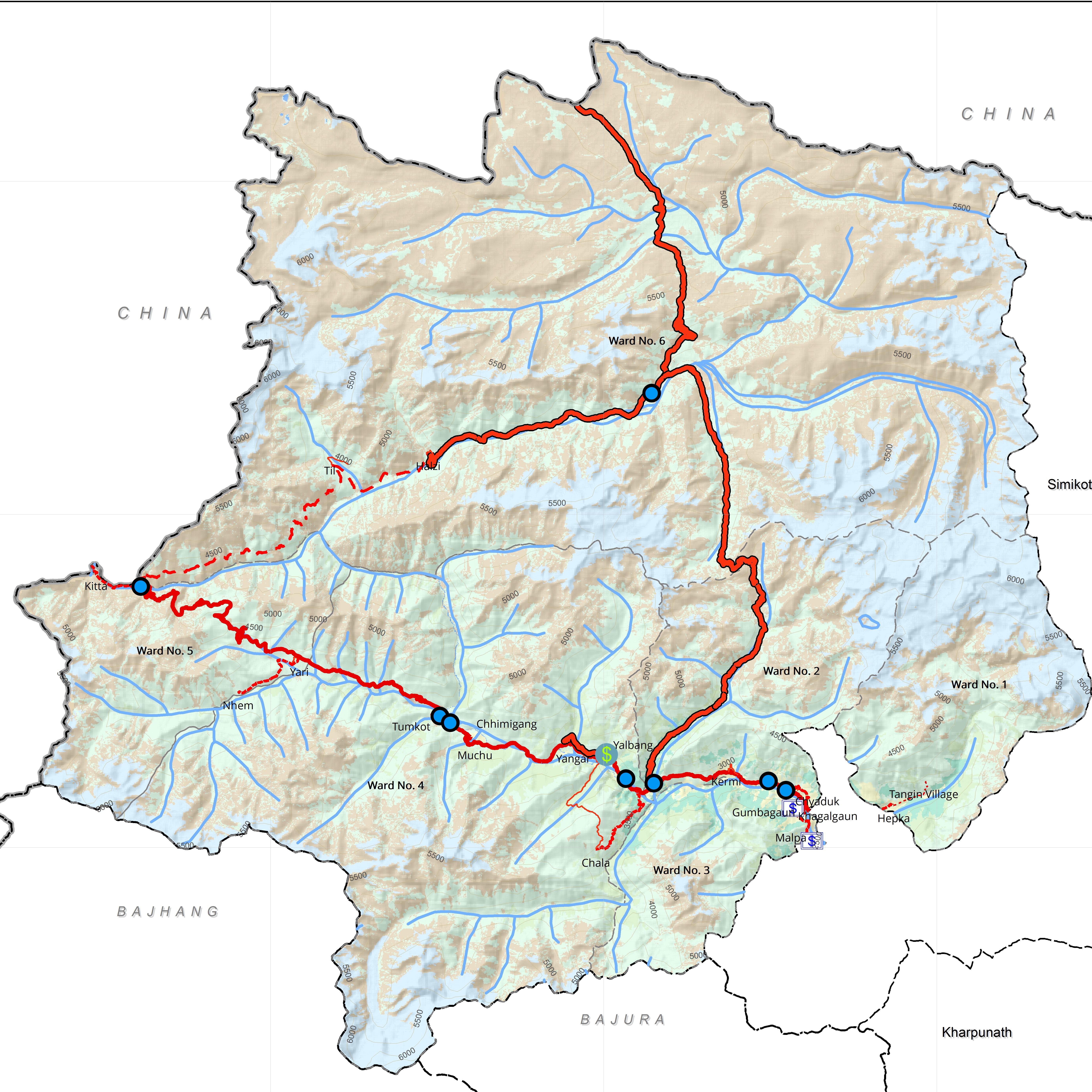
- Local Trails And Infrastructure Mapping under Emergency Preparedness and Response Project being implemented by the World Food Programme
GIS Intern
May, 2019 - June, 2019
International Center for Integrated Mountain Development (ICIMOD)
- Collect earth for land cover primitive assessment in the Hindu Kush Himalaya Region
- Google Earth Engine (GEE) workshop for land cover mapping
Education
Skills
I have serveral skills in the field of geospatial to create, manage, analysis and disseminate the data. Also, I am very interested to learn programming languages like Python, JavaScript. I have a keen interest in graphic design as well.

Python

ArcGIS Pro

ArcGIS Online

ArcGIS Experience Builder

ArcMap

QGIS

Google Earth Engine

Jupyter Notebook

Geoserver

Open Layers

PostgreSQL

R

GitHub

Virtual Studio Code
Contact
Location:
Colorado, US
Email:
prashantthapaliya8989@gmail.com
Call:
Not available

